
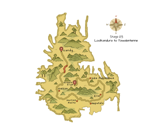
This stage begins in Tawalantenne where you will hike through small village roads flanked by rice paddy fields. You will cross the Ramboda Oya, which falls onto the popular Ramboda waterfall. Keep an eye out for delicious mulberries, which make for a tasty snack as you walk through manicured tea estates.
One of the highlights of the trail include views of the Kotmale Reservoir, the second-largest hydroelectric power station in Sri Lanka. You will also spot the Kadadora Viharaya, a Buddhist temple visible on the outer banks of the Kotmale Reservoir.
Trail INFO
Length: 15.53 km (9.65 mi)
Average Duration: 4 hours 30 minutes
People Interactions: High
Region: Kandy
Elevation Gain: 1195m (3,921 ft)
Elevation Loss: 1126m (3,694 ft)
Maximum Elevation: 1263m (4,144 ft)
DIFFICULTY
Forward: Difficult
Reverse: Difficult
Points of Interest
Kotmale Reservoir
Upper Kothmale power station
Ramboda Oya
Ramboda Falls
Malhawa bridge
Puna Ella Falls
Ancient Sri Dalada Karandu Purana Viharaya
Karnagala view point
Pundal Oya
Sri Muthumariamman Kovil
Emergency Points
TRAIL HEAD/END
The Pekoe Trail Stage 1 begins at: Loolkandura
The Pekoe Trail Stage 1 ends at: Tawalantenne
Stage Description
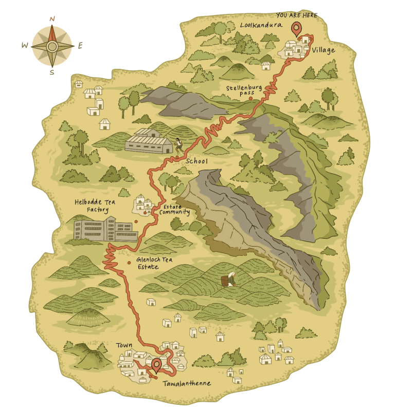
The third stage of the Pekoe Trail begins at a small bridge over the Ma Oya on the Loolkandura Estate. In the first hour of the hike, you’ll gain 250 meters in elevation, with a particularly challenging climb at the start. At 0.3 km, leave the main road and take the smaller path ascending to the right. By 0.8 km, you’ll reach a shed near a small school. Here, take the track to the right, and shortly after, you’ll spot a colorful Hindu Kovil and the Loolkandura Estate Bungalow below.
Over the next 3.5 km, the trail gently climbs, gaining around 300 meters in elevation. These trails, among Sri Lanka’s most scenic and historically significant tea paths, offer a tranquil journey. At 1.1 km, you’ll find a trail descending to a river with beautiful rock pools—a perfect spot for a short detour and a refreshing dip.
As you continue, a gentle uphill zig-zag awaits at 2.2 km, followed by 800 meters along the upper estate trails. The views of pine forests and striking rock formations to your right are stunning, and the higher you climb, the more remote the landscape feels. Looking ahead toward the forest and the pass, it seems as if a new world lies over the mountain, evoking a connection to the area’s rich history.
Leaving the last tea fields of the Loolkandura Estate, the trail enters the jungle, heightening the sense of adventure. The first 500 meters of the jungle trail involve a small uphill climb before veering right onto an easier path. Here, you’ll stand on the forgotten Dimbula Road, constructed over 150 years ago by British engineers to connect Kandy with the distant valleys for tea planting. The trail’s design—its gradient, width, and sturdy stonework—reflects the solid engineering of the 19th century, though nature has since reclaimed it.
The allure of the “valleys beyond,” as described in historical accounts, comes alive: a land of illusions, untouched wilderness, and a haven for wildlife such as elephants, deer, leopards, and eagles. This enchanting landscape, marked by misty meadows, dense forests, and vibrant orchids, evokes a sense of mystery and wonder.
At 4.7 km, you’ll cross a mountain pass and step into this “new world” on the Stellenberg Estate. From here, breathtaking views of the Kotmale Valley and the Rilagala mountain range unfold, and on clear days, Adam’s Peak is visible on the horizon.
For the next 4.5 km, the trail follows the relatively flat estate roads of the Stellenberg Estate, heading south. Along the way, you’ll pass a local village on your right and traverse lush tea fields. Unlike the shaded trails of Loolecondera, this section has fewer trees, so sunscreen and a hat are essential.
At the 10 km mark, the trail transitions to a poorly maintained tarmac road. Shortly after, at 10.5 km, leave the tarmac, continuing straight onto a descending estate road. This zig-zagging path cuts through forests and tea fields, offering magical views of the Kotmale Reservoir below.
Over the next 6 km, you’ll lose 500 meters in elevation. At 14.1 km, the trail passes a modern cottage and a private camping ground, offering glimpses of the Ramboda Pass, waterfalls, and the winding Gampola-Nuwara Eliya road.
The descent continues past a few homes and guesthouses, making it possible to rest or stay overnight directly along the trail. At the 16 km mark, the trail merges with the main road near the Glenoch Tea Factory, a convenient endpoint with parking.
For those continuing to Tawalantenne town, an additional 2 km along the main road is required. However, plans are underway to provide an alternative route to avoid this stretch.
The stage ends where the trail crosses the main road. The next stage begins 50 meters down a village track on the opposite side of the road. Tawalantenne “central” is just 200 meters to the right, offering further amenities and access points.
Responsible interaction with the environment to avoid depletion or degradation of natural resources and allow for long-term environmental quality.
Copyright © 2025 All Rights Reserved. Designed By Apex Innovations