
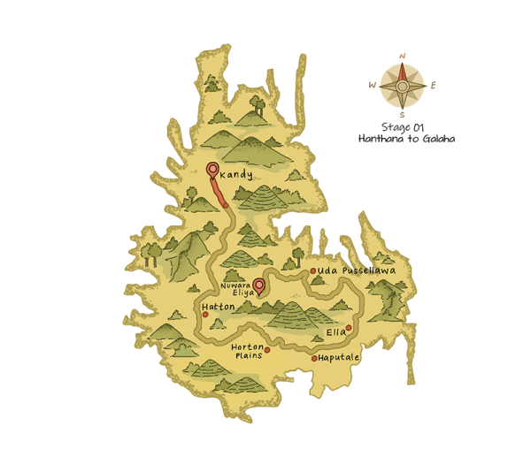
Lace-up your hiking boots for the very first stage of The Pekoe Trail taking you from Hanthana to Galaha. Begin your trek at the Ceylon Tea Museum (a place worth visiting if you’re keen on learning about the history of tea in Sri Lanka) and continue to walk in the shade of the tall trees that line the roads of the Hanthana Tea Estate, one of the oldest and largest tea plantations in Sri Lanka.
Trail INFO
Length: 12.84 km (7.98 mi)
Average Duration: 4 hours
People Interactions: High
Region: Kandy
Elevation Gain: 537m (1,762 ft)
Elevation Loss: 470m (1,542 ft)
Maximum Elevation: 1,067 m (3,501 ft)
DIFFICULTY
Forward: Easy
Reverse: Easy
Points of Interest
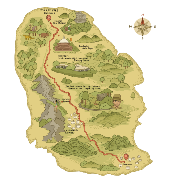
Ceylon Tea Museum
Upper Hanthana Church
Sandagiri Maha Stupa
Rathnasiri Wickramanayake National Training Center
Indiana Jones The Temple of the Doom Movie Set
Katusu Konda
Kithulmulla Vilage
Lunuwella Viharaya
Galaha Group Hindu Kovil
Emergency Points
TRAIL HEAD/END
The Pekoe Trail Stage 1 begins at: Ceylon Tea Museum – Hanthana
The Pekoe Trail Stage 1 ends at: Galaha Post Office.
Stage Description
The Pekoe Trail begins at the historic Ceylon Tea Museum, located on the scenic Hantana Estate. Housed in the former Hantana Tea Factory, the museum is a must-visit with ample parking and excellent restroom facilities. From here, the trail ascends gently through the lush landscapes of Hantana, offering stunning views of Kandy and the iconic seven peaks of the Hantana Mountain Range.
At 1.4 km, the trail reaches a crossroads with a small shop, perfect for a quick refreshment of Thambili (King Coconut) or bananas. Continuing along the concrete path, the route passes landmarks such as the W15 Hotel and the Hill Country Sport Shooting Club, climbing gradually. By 3.1 km, you’ll come across the Sugarcane Quarantine Center.
As the trail progresses, the concrete path transitions to gravel, flanked by charming cabanas. At 5.2 km, a side trail leads to a secluded stupa used for meditation. Out of respect, it’s best to avoid disturbing this peaceful site. The trail reaches its highest elevation of 1,008 meters at 5.7 km, where breathtaking views unfold, including the Victoria Reservoir and the majestic Knuckles Range.
From this peak, the trail descends gently towards Galaha. Along the way, you’ll encounter striking landscapes, including a dense forest of towering trees around the 10 km mark, and pass by quaint villages and homes. Film buffs will enjoy learning that parts of Indiana Jones and the Temple of Doom were shot in this area, adding a touch of cinematic history to the journey.
The lowest point of the trail lies at the 10.8 km mark, at 754 meters, as you cross a bridge over a river and enter a dense pine forest. Here, you can choose between a steep track or a winding road to ascend towards the Galaha Road, where this stage concludes. The endpoint is the Galaha Post Office, located just 900 meters further.
This stage of the Pekoe Trail offers an unforgettable blend of cultural landmarks, natural beauty, and historical intrigue, making it the perfect introduction to this enchanting journey.
Responsible interaction with the environment to avoid depletion or degradation of natural resources and allow for long-term environmental quality.
Copyright © 2025 All Rights Reserved. Designed By Apex Innovations